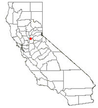
Antelope, California
| Antelope | |
|---|---|
| census-designated place | |
 Location of Antelope, California |
|
| Coordinates: 38°42′55″N 121°21′39″W / 38.71528°N 121.36083°WCoordinates: 38°42′55″N 121°21′39″W / 38.71528°N 121.36083°W | |
| Country | United States |
| State | California |
| County | Sacramento |
| Area | |
| • Total | 6.837 sq mi (17.708 km2) |
| • Land | 6.837 sq mi (17.708 km2) |
| • Water | 0 sq mi (0 km2) 0% |
| Elevation | 121 ft (37 m) |
| Population (2010) | |
| • Total | 45,770 |
| • Density | 6,700/sq mi (2,600/km2) |
| Time zone | PST (UTC-8) |
| • Summer (DST) | PST (UTC-7) |
| ZIP codes | 95843 |
| Area code(s) | 916 |
| U.S. Geological Survey Geographic Names Information System: Antelope, California | |
Antelope is a census-designated place in Sacramento County, California, United States located approximately 15 miles (24 km) northeast of downtown Sacramento and 5 miles (8 km) southwest of Roseville. The population was 45,770 at the 2010 census.
According to the United States Census Bureau, the community has a total area of 6.8 square miles (17.7 km2). Antelope is mostly flat, with very few hills and no major bodies of water.
The northern border of Antelope falls directly onto the line between Sacramento County and Placer County.
The eastern border first follows Roseville Road south from the county line to Butternut Drive. Then the border continues in the same general direction to Antelope Road, so that parcels on Adagio Way, Andante Drive and Katella Way are within Antelope CDP.
The southern border follows Antelope Road.
The western border has two parts. The first part extends from Antelope Rd northwards toward Elverta Rd along 28th St. The second part extends from Elverta Rd towards the Placer county line, along Dry Creek.
The boundaries were drawn and the town name established by a vote in 1993 to establish the community's identity. The Antelope, CA town designation began July 1, 1994. The ZIP code for Antelope: 95843
In the late 1800s, Antelope was the only significant settlement in the Center Township, an area bounded on the North by the Placer county line, on the East by what is now Sunrise Blvd., on the South by the American River, and on the West by the line along 20th St in Rio Linda south to Ethan Way in the Arden-Arcade area. The population of the entire township in 1880 was about 400 people. Many of the railroad workers made their homes here and eventually stayed permanently. Gradually, workers left the area and Antelope became just another small community with little business.
On April 28, 1973, Antelope consisted of a post office, general store and a half-dozen homes - a place hardly worthy of notice. However, at 8:03 a.m., a rail car loaded with aircraft bombs exploded in the southern part of the Southern Pacific's Roseville switch yard destroying the general store and damaging most of the homes. This event changed Antelope forever - it basically was blown away.
...
Wikipedia
