Annandale Way
| Annandale Way | |
|---|---|

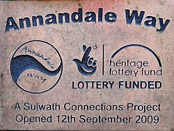
Plaque on the commemorative cairn at the start of the Annandale way - north end.
|
|
| Length | 53 mi (85 km) |
| Location | Scotland |
| Trailheads |
Moffat 55°24′36″N 3°26′55″W / 55.4101°N 3.4487°W Annan 54°58′04″N 3°16′56″W / 54.9678°N 3.2823°W |
| Use | Hiking |
| Elevation | |
| Highest point | 491 m (1,611 ft) |
| Lowest point | Sea level |
The Annandale Way is a 53-mile (85 km) hiking trail in Scotland. It follows the valley of the River Annan from its source in the Moffat Hills to the sea in the Solway Firth south of the town of Annan. The route, which was established on 12 September 2009, has been designed to be traversable in four to five days as a continuous walk but it also offers several fine day-walks. Overnight stops can be arranged in small market towns and villages along the route such as Moffat, Johnstonebridge, Lochmaben, Lockerbie, or Annan. The route has been developed by Sulwath Connections and local communities, with the support of local estates and farmers, to help promote Annandale as a new area for walking. Its trailheads are near the Devil's Beef Tub in the Moffat Hills and on the Solway Firth just south of Annan, in Newbie.
Way (right edge of the picture) with the Solway Firth and Criffel beyond; which is a hill near the mouth of the Nith estuary. The northernmost point of the walk is marked by a commemorative cairn at the head of the Tweedhope Burn in the saddle between Spout Craig and Chalk Ridge Edge (OS. Ref. NT084138). This is also on the watershed between the headwater systems of the river Annan to the south and the River Tweed to the north. This cairn is seen at the start of the route when walking it from north to south, although of course it is necessary to walk in from the nearest tarred road to get to this point. In fact this northernmost section of the Way, from Moffat up Annandale to the cairn, offers a loop such that one can get to the cairn from the east bank of the river Annan by the Tweedhope burn and then return by a circumnavigation of the Devil's Beef Tub to Annanhead and the west bank of the river. On the official website this loop out from Moffat and back is suggested as a 13-mile (21 km) day walk. Heading south from Moffat the Annandale Way joins the Southern Upland Way briefly near the village of , beyond which it passes through ancient oak forests and over farmland down the valley to near Templand, where again there is a choice of alternative routes.
...
Wikipedia
