Anatahan

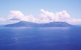
US Geological Survey photo of Anatahan
|
|
| Geography | |
|---|---|
| Location | Pacific Ocean |
| Coordinates | 16°21′5″N 145°40′43″E / 16.35139°N 145.67861°E |
| Archipelago | Northern Mariana Islands |
| Area | 33.9 km2 (13.1 sq mi) |
| Length | 9 km (5.6 mi) |
| Width | 4 km (2.5 mi) |
| Highest elevation | 790 m (2,590 ft) |
| Administration | |
|
United States
|
|
| Commonwealth | Northern Mariana Islands |
| Demographics | |
| Population | - uninhabited - (2010) |
| Anatahan | |
|---|---|

Ash from Anatahan, June 2005
|
|
| Highest point | |
| Elevation | 788 m (2,585 ft) |
| Coordinates | 16°21′N 145°40′E / 16.35°N 145.67°E |
| Geography | |
| Location | Northern Mariana Islands, Pacific Ocean |
| Geology | |
| Mountain type | Stratovolcano |
| Last eruption | 2007 – 2008 |
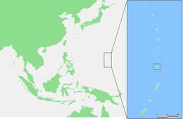
Anatahan is an island in the Northern Mariana Islands in the Pacific Ocean, and has one of the most active volcanoes of the archipelago. Formerly inhabited, the island currently does not have any population due to the always-present danger of volcanic eruptions. Anatahan is located 60 kilometers (32 nmi) northwest of Farallon de Medinilla and 120 km (65 nmi) north of Saipan.
Anatahan is roughly elliptical in shape, with a length of 9 kilometers (5.6 mi) and a width of 4 km (2.5 mi) and an area of 33.9 km2 (13.1 sq mi). The island is the summit of stratovolcano which reaches an altitude of 790 m (2,592 ft) above sea level at its highest peak.
The volcano is topped by a caldera, 2.3 km (1.4 mi) wide, which is divided into an eastern and western portion, with the eastern portion around 250 m (820 ft) lower than the western. Sparseness of vegetation in the most recent lava flows on Anatahan indicated that they were of Holocene age. In April 1990, the inhabitants of the western coast of the island were evacuated after earthquake swarms and active fumaroles indicated that an eruption might be imminent, but no eruption occurred at that time. Further earthquake swarm occurred in May 1992. The first historical eruption of Anatahan occurred in May 2003, when a large explosive eruption with a VEI of 4 took place forming a new crater inside the eastern caldera and causing an ash plume 12 km (7.5 mi) high which impaired air traffic to Saipan and Guam.
The most recent eruption was in 2007, and lasted until 2008.
The island was first charted by Europeans in late October 1543 by Spanish explorer Bernardo de la Torre on board of the carrack San Juan de Letrán when trying to return from Sarangani to New Spain. At the time, the island was settled by the Chamorros. In 1695, the natives were forcibly removed to Saipan, and three years later to Guam. Under Spanish rule, coconut plantations were developed for the production of copra. In 1884, an estimated 125 tons were exported.
...
Wikipedia

