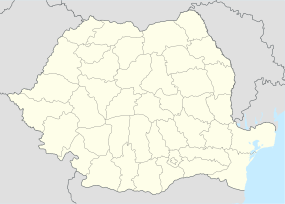
Amutria
| Alternate name | Amutrion, Amutrium, Admutrium, Ad Mutrium, Ad Mutriam |
|---|---|
| Location | Mehedinți County, Romania |
| Coordinates | 44°50′N 22°55′E / 44.83°N 22.91°ECoordinates: 44°50′N 22°55′E / 44.83°N 22.91°E |
Amutria (Amutrion, Amutrium, Admutrium,Ad Mutrium, Ad Mutriam, Ancient Greek: Ἀμούτριον) was a Dacian town close to the Danube and included in the Roman road network, after the conquest of Dacia.
The name is homonymous with the ancient name of the nearby Motru River. Its possible position at this river's junction gives a certain importance.
Amutria is mentioned in Ptolemy's Geographia (c. 150 AD) in the form Amutrion (Ancient Greek: Ἀμούτριον) as an important Dacian town, at latitude 50° 00' N and longitude 44° 45' E (note that he used a different meridian and some of his calculations were off). It is located on a road between Drubetis and Potulatensioi.
Amutria is also depicted in the Tabula Peutingeriana (2nd century AD) between Drubetis and Pelendava, on one of the three roads build by Emperor Trajan in Dacia. The road was connecting into Via Trajana and most likely crossing Trajan's Bridge over the Danube. The location corresponds to the one mentioned by Ptolemy.
Romanian archaeologist and historian , assumes that Amutria should be read Ad-mutriam, Ad Mutriam or Ad Mutrium, meaning by/at the Mutrium (Motru). The modern Romanian linguist Sorin Olteanu is also suggesting the form Ad Mutrius, with Mutrius possibly being the ancient name of Motru River.
Amutria is hypothetically located at one of the following sites in Oltenia (Southwestern Romania):
Based on the archaeological survey and excavations performed at Cătunele in 1885, 1973, and later in 1981-84, a Roman castrum and civilian settlement was discovered.
...
Wikipedia

