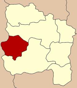
Amphoe Samko
|
Sam Ko สามโก้ |
|
|---|---|
| Amphoe | |
 Amphoe location in Ang Thong Province |
|
| Coordinates: 14°36′20″N 100°14′41″E / 14.60556°N 100.24472°ECoordinates: 14°36′20″N 100°14′41″E / 14.60556°N 100.24472°E | |
| Country |
|
| Province | Ang Thong |
| Tambon | 5 |
| Muban | 37 |
| Area | |
| • Total | 95.4 km2 (36.8 sq mi) |
| Population (2012) | |
| • Total | 19,314 |
| • Density | 200/km2 (520/sq mi) |
| Time zone | THA (UTC+7) |
| Postal code | 14160 |
| Geocode | 1507 |
Sam Ko (Thai: สามโก้) is the district (Amphoe) in the western part of Ang Thong Province, central Thailand.
The district was separated from Wiset Chai Chan district to become a minor district (King Amphoe) in 1962. It was upgraded to full district in 1965.
Neighboring districts are (from the north clockwise) Pho Thong and Wiset Chai Chan of Ang Thong Province and Si Prachan of Suphanburi Province.
The district is subdivided into 5 subdistricts (tambon) and 37 administrative villages (muban). The subdistrict municipality (thesaban tambon) Samko covers the tambon Samko, Ratsadon Phatthana and Mongkhon Tham Nimit. Op Thom and Pho Muang Phan have a Tambon administrative organization as their local government.
...
Wikipedia
