Amphoe Lamduan
|
Lamduan ลำดวน |
|
|---|---|
| Amphoe | |
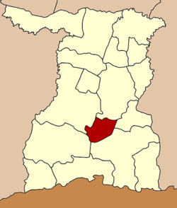
 Amphoe location in Surin Province |
|
| Coordinates: 14°43′38″N 103°40′33″E / 14.72722°N 103.67583°ECoordinates: 14°43′38″N 103°40′33″E / 14.72722°N 103.67583°E | |
| Country |
|
| Province | Surin |
| Seat | Lamduan |
| Area | |
| • Total | 301.0 km2 (116.2 sq mi) |
| Population (2005) | |
| • Total | 30,059 |
| • Density | 99.9/km2 (259/sq mi) |
| Time zone | THA (UTC+7) |
| Postal code | 32220 |
| Geocode | 3211 |
Lamduan (Thai: ลำดวน) is a district (Amphoe) in the central part of Surin Province, northeastern Thailand.
The district goes back to the Mueang Suraphi Nathon Nikhom (สุรพินทรนิคม), which was established in 1871. In 1896 it was converted into the district Lamduan, which was later dissolved.
On January 3, 1977 it was reestablished as a minor district (King Amphoe) by splitting off the two tambon Lamduan and Chok Nuea from Sangkha district. It was upgraded to a full district on July 19, 1991.
Neighboring districts are (from the north clockwise) Sikhoraphum, Si Narong, Sangkha, Prasat and Mueang Surin.
The district is subdivided into 5 subdistricts (tambon), which are further subdivided into 51 villages (muban). Lamduan Sunphin is a township (thesaban tambon) which covers parts of the tambon Lamduan. There are further 5 Tambon administrative organizations (TAO).
...
Wikipedia
