Amphoe Hang Dong
|
Hang Dong หางดง |
|
|---|---|
| Amphoe | |
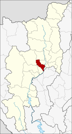
 Amphoe location in Chiang Mai Province |
|
| Coordinates: 18°41′13″N 98°55′8″E / 18.68694°N 98.91889°ECoordinates: 18°41′13″N 98°55′8″E / 18.68694°N 98.91889°E | |
| Country |
|
| Province | Chiang Mai |
| Tambon | 11 |
| Muban | 109 |
| Area | |
| • Total | 277.1 km2 (107.0 sq mi) |
| Population (2014) | |
| • Total | 83,310 |
| • Density | 300.6/km2 (779/sq mi) |
| Time zone | ICT (UTC+7) |
| Postal code | 50230 |
| Geocode | 5015 |
Hang Dong (Thai: หางดง) is a district (amphoe) of Chiang Mai Province in northern Thailand.
Neighboring districts are (from the southwest clockwise) San Pa Tong, Mae Wang, Samoeng, Mae Rim, Mueang Chiang Mai, Saraphi of Chiang Mai Province, and Mueang Lamphun of Lamphun Province.
The village Ban Tawai (บ้านถวาย) in Khun Khong subdistrict is famous for its handicraft center, as wood carving has been a local speciality since the 1960s. Hang Dong has a 9 hole golf course on the canal road.
Before 1917, the district was named Mae Tha Chang (แม่ท่าช้าง). 1938 the district was downgraded to a minor district (king amphoe) and made subordinate of Mueang Chiang Mai district. 1947 it was elevated to full district status again.
The district Hang Dong is subdivided into 11 subdistricts (Tambon), which are further subdivided into 109 administrative villages (Muban).
There are 10 subdistrict municipalities (Thesaban Tambon) in the district:
There are two subdistrict administrative organizations (SAO) in the district:
Wat Ton Kwaen, Hang Dong, (from 1858 CE), 8 km SW of Chiang Mai's city walls
Wihan, Wat Ton Kwaen, showing the wood carving
Interior view of the wihan
...
Wikipedia
