Amboy, California
| Amboy, California | |
|---|---|
| Unincorporated community | |

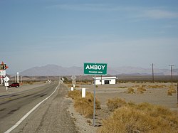
Amboy sign, west side of town
|
|
| Location within the state of California | |
| Coordinates: 34°33′25″N 115°44′42″W / 34.55694°N 115.74500°WCoordinates: 34°33′25″N 115°44′42″W / 34.55694°N 115.74500°W | |
| Country | United States |
| State | California |
| County | San Bernardino |
| Founded | 1883 |
| Population (2000) | |
| • Total | 4 |
| Time zone | Pacific (PST) (UTC-8) |
| • Summer (DST) | PDT (UTC-7) |
| ZIP codes | 92304 |
| Area codes | 442/760 |
| GNIS feature ID | 238579 |
Amboy is an unincorporated community in San Bernardino County, in California's Mojave Desert, west of Needles and east of Ludlow on historic Route 66. It is roughly 60 miles (97 km) northeast of Twentynine Palms. Prior to 2015, the town's business district contains a post office, a historic restaurant-motel, and a Route 66 tourist shop.
The town is south of the Granite Mountains, Providence Mountains, and the Mojave National Preserve. Adjacent to the south is the landmark Amboy Crater, and beyond to the southeast the Bullion Mountains. To the south is Bristol Dry Lake and Cadiz, California.
Amboy was once a major stop along famous Route 66 but has seen much lower visitation since the opening of Interstate 40 to the north in 1973. Amboy is home to the famous Roy's Motel and Café, a Route 66 landmark.
The town has a total of 10 surviving buildings and a population of far fewer than the advertised 20. According to the Los Angeles Times, the town's population is approximately 4. A resident interviewed in a short 2014 documentary also gives the population as 4, all of whom are men. Amboy is located in ZIP code 92304 and area codes 442 and 760.
...
Wikipedia

