Amazonis quadrangle

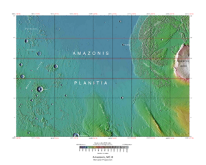
Map of Amazonis quadrangle from Mars Orbiter Laser Altimeter (MOLA) data. The highest elevations are red and the lowest are blue.
|
|
| Coordinates | 15°00′N 157°30′W / 15°N 157.5°WCoordinates: 15°00′N 157°30′W / 15°N 157.5°W |
|---|---|
The Amazonis quadrangle is one of a series of 30 quadrangle maps of Mars used by the United States Geological Survey (USGS) Astrogeology Research Program. The Amazonis quadrangle is also referred to as MC-8 (Mars Chart-8).
The quadrangle covers the area from 135° to 180° west longitude and 0° to 30° north latitude on Mars. The Amazonis quadrangle contains the region called Amazonis Planitia. This area is considered to be among the youngest parts of Mars because it has a very low density of craters. The Amazonia period is named after this area. This quadrangle contains special, unusual features called the Medusae Fossae Formation and Sulci.
The Amazonis quadrangle is of great interest to scientists because it contains a big part of a formation, called the Medusae Fossae Formation. It is a soft, easily eroded deposit that extends for nearly 1,000 km along the equator of Mars. The surface of the formation has been eroded by the wind into a series of linear ridges called yardangs. These ridges generally point in direction of the prevailing winds that carved them and demonstrate the erosive power of Martian winds. The easily eroded nature of the Medusae Fossae Formation suggests that it is composed of weakly cemented particles, and was most likely formed by the deposition of wind-blown dust or volcanic ash. Using a global climate model, a group of researchers headed by Laura Kerber found that the Medusae Fossae Formation could have easily been formed from ash from the volcanoes Apollinaris Mons, Arsia Mons, and possibly Pavonis Mons. Another evidence for a fine-grained composition is that the area gives almost no radar return. For this reason it has been called a "stealth" region. Layers are seen in parts of the formation. Images from spacecraft show that they have different degrees of hardness probably because of significant variations in the physical properties, composition, particle size, and/or cementation. Very few impact craters are visible throughout the area so the surface is relatively young.
...
Wikipedia
