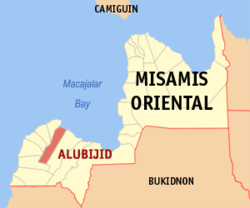
Alubijid, Misamis Oriental
| Alubijid | ||
|---|---|---|
| Municipality | ||
|
||
 Map of Misamis Oriental with Alubijid highlighted |
||
| Location within the Philippines | ||
| Coordinates: 08°34′N 124°28′E / 8.567°N 124.467°ECoordinates: 08°34′N 124°28′E / 8.567°N 124.467°E | ||
| Country | Philippines | |
| Region | Northern Mindanao (Region X) | |
| Province | Misamis Oriental | |
| District | 2nd district of Misamis Oriental | |
| Barangays | 16 | |
| Government | ||
| • Mayor | Alvin Giovanni Labis | |
| Area | ||
| • Total | 85.56 km2 (33.03 sq mi) | |
| Population (2015 census) | ||
| • Total | 29,724 | |
| • Density | 350/km2 (900/sq mi) | |
| Time zone | PST (UTC+8) | |
| ZIP code | 9018 | |
| IDD : area code | +63 (0)88 | |
| Income class | 4th municipal income class | |
| 104301000 | ||
| Electorate | 18,675 voters as of 2016 | |
| Website | www |
|
Alubijid is a fourth class municipality in the province of Misamis Oriental, Philippines. According to the 2015 census, it has a population of 29,724 people.
The municipality name, "Alubijid", pronounced alubihid due to Spanish accent, is the local term for the hog plum tree.
Alubijid is politically subdivided into 16 barangays.
College:
High School
Elementary
...
Wikipedia


