Allgood, Alabama
| Allgood, Alabama | |
|---|---|
| Town | |
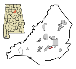
 Location in Blount County and the state of Alabama |
|
| Coordinates: 33°54′15″N 86°30′59″W / 33.90417°N 86.51639°W | |
| Country | United States |
| State | Alabama |
| County | Blount |
| Area | |
| • Total | 1.0 sq mi (2.7 km2) |
| • Land | 1.0 sq mi (2.7 km2) |
| • Water | 0 sq mi (0 km2) |
| Elevation | 787 ft (240 m) |
| Population (2010) | |
| • Total | 622 |
| • Density | 599/sq mi (231.2/km2) |
| Time zone | Central (CST) (UTC-6) |
| • Summer (DST) | CDT (UTC-5) |
| ZIP code | 35013 |
| Area code(s) | 205 |
| FIPS code | 01-01396 |
| GNIS feature ID | 0113021 |
Allgood, formerly known as Chepultepec, is a town in Blount County, Alabama, United States. At the 2010 census the population was 622.
Allgood is located in south-central Blount County at 33°54′15″N 86°30′59″W / 33.90417°N 86.51639°W (33.904216, -86.516428). It is in the Murphree Valley, with Straight Mountain to the southeast and Red Mountain and Sand Mountain to the northwest. Alabama State Route 75 passes through the town, leading northeast 3 miles (5 km) to Oneonta, the county seat, and southwest 38 miles (61 km) to Birmingham.
According to the U.S. Census Bureau, the town has a total area of 1.0 square mile (2.6 km2), all land.
As of the census of 2000, there were 629 people, 189 households, and 140 families residing in the town. The population density was 606.6 people per square mile (233.5/km²). There were 198 housing units at an average density of 190.9 per square mile (73.5/km²). The racial makeup of the town was 83.94% White, 0.32% Black or African American, 0.48% Native American, 12.08% from other races, and 3.18% from two or more races. 43.40% of the population were Hispanic or Latino of any race.
...
Wikipedia
