Alice Springs Airport
| Alice Springs Airport | |||||||||||||||
|---|---|---|---|---|---|---|---|---|---|---|---|---|---|---|---|
 |
|||||||||||||||
 |
|||||||||||||||
| Summary | |||||||||||||||
| Airport type | Public | ||||||||||||||
| Owner | Northern Territory Airports Pty Ltd | ||||||||||||||
| Operator | Alice Springs Airport Pty Ltd | ||||||||||||||
| Serves | Alice Springs, Northern Territory | ||||||||||||||
| Elevation AMSL | 1,789 ft / 545 m | ||||||||||||||
| Coordinates | 23°48′25″S 133°54′08″E / 23.80694°S 133.90222°ECoordinates: 23°48′25″S 133°54′08″E / 23.80694°S 133.90222°E | ||||||||||||||
| Website | www.alicespringsairport.com.au | ||||||||||||||
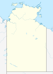
| Map | |||||||||||||||
| Location in the Northern Territory | |||||||||||||||
| Runways | |||||||||||||||
|
|||||||||||||||
| Statistics (2011) | |||||||||||||||
|
|||||||||||||||
|
Sources: Australian AIP and aerodrome chart. Passenger and aircraftmovements from the Department of Infrastructure and Transport
|
|||||||||||||||
| Passengers | 598,749 |
|---|---|
| Aircraft movements | 6,670 |
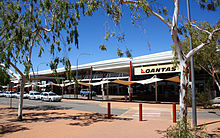
Alice Springs Airport (IATA: ASP, ICAO: YBAS) is a regional airport 7 nautical miles (13 km; 8.1 mi) south of Alice Springs, Northern Territory. The airport was notably involved in Australia's first domestic airline hijacking, and later a suicide attack by a former airline employee which claimed the lives of four others.
The airport has two runways, the largest of which can accommodate a Boeing 747 or 777 landing (but not a fully laden takeoff due to high temperatures and the runway length). The only scheduled flights using the airport are domestic, although international charters do use the airport on occasions. The airport is not subject to a curfew and operates 24 hours a day.
During 2010–11 a total of 640,519 domestic passengers passed through Alice Springs Airport making it the 18th busiest airport in Australia.
The facility is also extensively used to launch stratospheric research balloons; the runways used for a balloon launch are closed for aircraft traffic during the balloon launch process.
On 5 October 1921 the first aircraft landed at the original airport located in the Alice Springs township. Connellan Airways (later to become Connair) was based there from 1939. The military buildup in the north of Australia in the late 1930s saw the need for an airport that could take larger and heavier aircraft. This led to the construction of Seven Mile Aerodrome and the diminished role of the Town Site Drome from 1946 until its eventual abandonment in 1968. It is now the site of the Central Australian Aviation Museum.
Seven Mile Aerodrome was originally built in 1940 by the Australian Department of Defence and was used primarily by the Royal Australian Air Force and the United States Air Force, to bring troops and supplies into the area. The airport became the main transit base for RAAF transport planes during World War II. Several civilian aircraft were permitted at the airport, but during the war its primary purpose was military as a refuelling and staging facility, as the airport was strategically located near the Pacific Theater of Operations. No. 57 Operational Base Unit (RAAF) ran and maintained the aerodrome.
...
Wikipedia

