Alderton, Northamptonshire
| Alderton Saxon "Aldrintone" |
|
|---|---|
 Alderton |
|
| Alderton Saxon "Aldrintone" shown within Northamptonshire |
|
| Population | 248 (with Grafton Regis) 2010 est.109 (Alderton) |
| OS grid reference | SP7446 |
| • London | 62 miles (100 km) |
| Civil parish |
|
| District | |
| Shire county | |
| Region | |
| Country | England |
| Sovereign state | United Kingdom |
| Post town | TOWCESTER |
| Postcode district | NN12 |
| Dialling code | 01327 |
| Police | Northamptonshire |
| Fire | Northamptonshire |
| Ambulance | East Midlands |
| EU Parliament | East Midlands |
| UK Parliament |
|
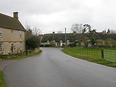
Alderton is a small English village and civil parish about 9 miles (14.5 km) south of Northampton, and 10 miles (16.1 km) north of Milton Keynes, along a road between the A5 and A508 main roads in the southwest and northeast respectively. The nearest large town is Towcester, about 3 miles (4.8 km) north. The village is famous for the remains of an English Heritage Scheduled Ancient Monument, a Norman Castle, known locally as "The Mount", which was the subject of an investigation by the Channel 4 programme Time Team.
The 2001 census data is grouped with the nearby village of Grafton Regis and showed there were 248 people living in both villages, 134 male, 114 female, in 94 dwellings. The majority of these being in Grafton Regis. In 2009 the estimated population of Alderton itself was 109. At the 2011 census the population continued to be included in the civil parish of Grafton Regis
The parish was merged with Grafton Regis in 1935. An independent Parish Council for the village was re-established on 1 April 2004.
The local district council is South Northamptonshire and Alderton is in the area of Northamptonshire County Council.
Alderton is on the southern ridge of the valley of the River Tove which flows east between the village and Stoke Bruerne to the north. Stoke Bruerne church and Stoke Park Pavilions are clearly visible in the distance.
...
Wikipedia

