Alderbury
| Alderbury | |
|---|---|
 |
|
| Alderbury shown within Wiltshire | |
| Population | 2,223 (in 2011) |
| OS grid reference | SU189271 |
| Civil parish |
|
| Unitary authority | |
| Ceremonial county | |
| Region | |
| Country | England |
| Sovereign state | United Kingdom |
| Post town | Salisbury |
| Postcode district | SP5 |
| Dialling code | 01722 |
| Police | Wiltshire |
| Fire | Dorset and Wiltshire |
| Ambulance | South Western |
| EU Parliament | South West England |
| UK Parliament | |
| Website | Parish Council |
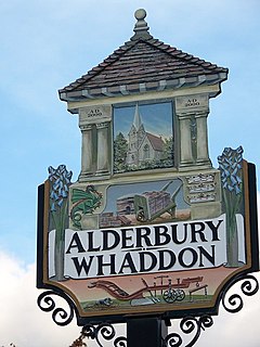
Alderbury is a village and civil parish in Wiltshire, England, about 3 miles (5 km) southeast of Salisbury.
The parish includes the village of Whaddon, which is adjacent to Alderbury, and the hamlet of Shute End. The Hampshire Avon]] forms the western boundary of the parish. The villages are on the Salisbury-Southampton road which became the A36 primary route; a bypass was opened in 1978, taking the A36 to the east of the villages.
A church at Alderbury was recorded in the 1086 Domesday Book. A new parish church of St Mary was erected on the same foundations in 1857-58 to designs by S.S. Teulon, with stained glass by Henry Holiday; Clayton and Bell; Heaton, Butler and Bayne; and William Morris. The church is Grade II listed.
There was a church or chapel at Whaddon in the 12th to 14th centuries, which fell into disuse sometime before 1536.
Ivychurch Priory, near Alderbury, was an Augustinian monastery established in the 12th century and dissolved in 1536.
A Wesleyan Methodist chapel was bult at Alderbury in 1825 and demolished in 1970. A Primitive Methodist chapel built at Whaddon in 1884 became a Roman Catholic chapel in 1990.
Alderbury House, near St Mary's church, is a Grade II* listed country house from the late 18th century.
...
Wikipedia

