Aldbourne
| Aldbourne | |
|---|---|
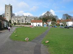
 St. Michael's parish church and village green |
|
| Aldbourne shown within Wiltshire | |
| Population | 1,833 (2011 Census) |
| OS grid reference | SU265756 |
| Unitary authority | |
| Ceremonial county | |
| Region | |
| Country | England |
| Sovereign state | United Kingdom |
| Post town | Marlborough |
| Postcode district | SN8 |
| Dialling code | 01672 |
| Police | Wiltshire |
| Fire | Dorset and Wiltshire |
| Ambulance | South Western |
| EU Parliament | South West England |
| UK Parliament | |
| Website | The Aldbourne Net |
Aldbourne is a village and civil parish about 6 miles (10 km) north-east of Marlborough in Wiltshire, England. It is in a valley in the south slope of the Lambourn Downs, which are part of the North Wessex Downs Area of Outstanding Natural Beauty. From here an unnamed winterbourne flows and joins the River Kennet 4 miles (6 km) south near the village of Ramsbury. The 2011 Census recorded the parish population as 1,833. It includes the hamlets of Upper Upham and Woodsend, and part of the hamlet of Preston which straddles the boundary with Ramsbury parish. The small village of Snap was deserted in the early 20th century.
Lewisham Castle is a small medieval ringwork about 1 1⁄2 miles (2.4 km) south-west of the village. It is not certain whether it was in fact a castle.
In the English Civil War a Royalist force led by Prince Rupert fought a Parliamentarian force in a skirmish at Aldbourne Chase on 18 September 1643, two days before the First Battle of Newbury.
A Baptist chapel was opened in 1841 in Back Lane and rebuilt as New Zoar Chapel in 1868. The chapel was sold in 1914 and demolished at some time after 1931; its burial ground survives.
...
Wikipedia

