Alajuela (city)
| Alajuela | ||||||||||
|---|---|---|---|---|---|---|---|---|---|---|
| City and municipality | ||||||||||
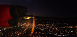
Images, from top down, left to right: Alajuela skyline at night, Central Church, Juan Santamaría Statue, Central Park, Municipal Theater, a traditional Costa Rican bullock cart, the Juan Santamaría International Airport, Alejandro Morera Soto Stadium.
|
||||||||||
|
||||||||||
| Nickname(s): Ciudad de los Mangos (Spanish) "City of Mangoes" |
||||||||||
| Motto: Pro Patria Nostra — Sanguis Noster (Latin) "For our country, our blood" |
||||||||||
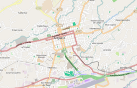
 Alajuela and surrounding area |
||||||||||
| Location of Alajuela within Costa Rica | ||||||||||
| Coordinates: 10°01′N 84°13′W / 10.017°N 84.217°W | ||||||||||
| Country | Costa Rica | |||||||||
| Province | Alajuela Province | |||||||||
| Canton | Alajuela | |||||||||
| Founded | 1782 | |||||||||
| Government | ||||||||||
| • Mayor | Roberto Thompson | |||||||||
| Area | ||||||||||
| • City and municipality | 8.88 km2 (3.43 sq mi) | |||||||||
| Elevation | 952 m (3,123 ft) | |||||||||
| Population (2012) | ||||||||||
| • City and municipality | 42,975 | |||||||||
| • Density | 4,800/km2 (13,000/sq mi) | |||||||||
| • Urban | 123,481 | |||||||||
| Postal code | 20101-114 | |||||||||
| Climate | Aw | |||||||||
| Website | Official website | |||||||||
Alajuela (Spanish pronunciation: [alaˈxwela]) is the second-largest city in Costa Rica after the capital, San José. It is also the capital of Alajuela Province.
Because of its location in the Costa Rican Central Valley, Alajuela is nowadays part of the conurbation of the Great Metropolitan Area. The city is the birthplace of Juan Santamaría, the national hero of Costa Rica and the figure who gives the name to the country's main international airport, which is south of Alajuela downtown.
The limits of the city corresponds formally to the canton's first district limits, even though the city's current population and urban area stretches beyond these limits. The district of Alajuela covers an area of 8.88 km², It lies at an elevation of 952 metres above sea level in the Central Valley, 19 kilometres northwest of San José.
The climate is tropical, typical of the Central Valley, but slightly warmer than San José. Temperatures are moderate, averaging 23–26 degrees Celsius with a low humidity level of 20% almost all year round. Alajuela and its surroundings are famed for having "the best weather in the world".
According to the 2000 Census, the urban area of the city had a population of 123,481 (including the district of Alajuela and the urban population of other districts in Alajuela canton). The population of the district in 2009 was 50,753 people.
In pre-Columbian times the land where the canton of Alajuela is today was part of the Huetar Kingdom of the West, which was inhabited by native tribes, who at the time of the Spanish conquest were led by Chief Garabito.
...
Wikipedia


