Adel, Oregon
| Adel | |
|---|---|
| Unincorporated community | |

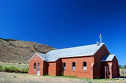
Saint Richard Catholic Church in Adel
|
|
| Location in Oregon | |
| Coordinates: 42°10′39″N 119°53′51″W / 42.1775°N 119.8974°WCoordinates: 42°10′39″N 119°53′51″W / 42.1775°N 119.8974°W | |
| Country | United States |
| State | Oregon |
| County | Lake |
| Elevation | 4,547 ft (1,386 m) |
| Time zone | Pacific (UTC-8) |
| • Summer (DST) | Pacific (UTC-7) |
| Zip Code | 97620 |
| Elevation from the Geographic Names Information System | |
Adel is an unincorporated community in southeastern Lake County, in the U.S. state of Oregon. The community is in an arid, sparsely populated part of the state, along Oregon Route 140, about 30 miles (48 km) east of Lakeview. The Warner Valley surrounding Adel contains many marshes and shallow lakes, most of them intermittent.
Frequented by Native Americans for many thousands of years, the valley became a region of sheep grazing and cattle ranching by the late 19th century. Adel's infrastructure includes a store, an elementary school, and a church. Hot springs and related geological features have made one of the nearby ranches a potential site for a geothermal power station.
People have lived in the Warner Valley for more than 10,000 years. Evidence of Native American occupation includes petroglyphs, hunting blinds, flakes from obsidian tools, and other material artifacts. By historic times, the Kidütökadö band of Northern Paiute frequented the valley and the uplands of Hart Mountain, the fault block ridge to the east.
The Euro-American settler community of Adel developed in the late 19th century around sheep grazing and small cattle ranches. Catholics from Ireland found work here as shepherds; their surnames and their churches are part of the regional heritage. A stagecoach line connected early Adel to Fort Bidwell in northern California and offered transportation three times a week. J. J. Monroe owned the Adel store.
...
Wikipedia


