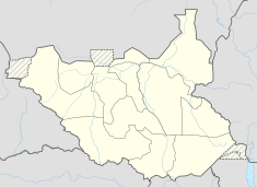
Adar oilfield
| Adar oilfield | |
|---|---|

Oil concessions in Sudan & South Sudan as of 2004. Block 3 (Adar) in the east.
|
|
| Location of Adar oilfield | |
| Country | South Sudan |
| Region | White Nile state |
| Block | 3 |
| Offshore/onshore | Onshore |
| Coordinates | 10°00′29″N 32°57′32″E / 10.008014°N 32.958759°ECoordinates: 10°00′29″N 32°57′32″E / 10.008014°N 32.958759°E |
| Operator | PetroDar |
| Field history | |
| Discovery | 1981 |
| Start of development | 1996 |
| Start of production | 1997 |
| Production | |
| Producing formations | Yabus Formation |
The Adar oilfield, also known as the Adar Yale, Adar Yeil or Adaril field, is an oilfield situated in the Melut Basin in South Sudan estimated to contain about 276 million barrels (43,900,000 m3) of oil. The Chevron Corporation discovered the Adar Yale field in 1981, shortly before the start of the Second Sudanese Civil War (1983–2005). Soon after Chevron had suspended operations in 1984, Sudanese government troops began attacking civilian settlements in the area, burning the houses and driving the people away, and in the late 1990s, Nuer militias from Nasir helped the army in clearing away the people to make way for the roads and infrastructure of the oilfield.
President Omar al-Bashir inaugurated the site in March 1997, and it initially produced just 5,000 barrels (790 m3) a day. Production from this oilfield, which lies close to the borders with Sudan and Ethiopia, has the potential to bring significant economic benefits to the region. However, until recently the focus has been on clearing the population away from the oilfield rather than on a longer term strategy for developing the region. China has provided a large investment in the Adar oilfield and others in South Sudan and Sudan and has made plans to make extensive further investments.
Adar is an area southeast of Melut, which lies on the White Nile in Upper Nile state, and to the west of Ethiopia. The Khor Adar, which drains the Machar Marshes, flows through the region in a northwest direction to the Nile, which it reaches just above Melut. The Khor Machar swamps lie in a triangle north of the Sobat River and east of the White Nile. When flooded during the wet season, they extend for 6,500 square kilometres (2,500 sq mi). The swamps and marshes are fed by local rainfall and by many small torrents from the Ethiopian foothills, which extend for 200 kilometres (120 mi) along the eastern border, and by spill water from channels of the Sobat.
...
Wikipedia

