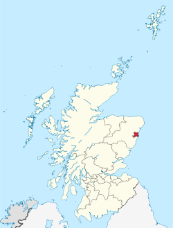
Aberdeen City council area
| Aberdeen | |||
|---|---|---|---|
| City | |||

Clockwise from top-left: Marischal College, West Tower of the new Town House on Union Street, cityscape view from Tollohill Woods, Old Aberdeen High Street, Aberdeen Beach
|
|||
|
|||
| Nickname(s): "Granite City", "Grey City", "Silver City with the Golden Sands" | |||
 Location within Scotland |
|||
| Coordinates: 57°09′09″N 2°06′36″W / 57.1526°N 2.1100°WCoordinates: 57°09′09″N 2°06′36″W / 57.1526°N 2.1100°W | |||
| Sovereign state |
|
||
| Country |
|
||
| Council area | Aberdeen City | ||
| Lieutenancy area | Aberdeen | ||
| Earliest Charter | 1179 | ||
| City status | 1891 | ||
| Government | |||
| • Governing body | Aberdeen City Council | ||
| • Lord Provost | George Adam | ||
| • MSPs |
|
||
| • MPs |
|
||
| Area | |||
| • Total | 185.7 km2 (71.7 sq mi) | ||
| Population (mid-2015 est.) | |||
| • Total | 230,400 | ||
| • Density | 1,240/km2 (3,200/sq mi) | ||
| • Language(s) | Scots (Doric), English | ||
| Demonym(s) | Aberdonian | ||
| Time zone | GMT (UTC±0) | ||
| • Summer (DST) | BST (UTC+1) | ||
| Postcode areas | AB10-AB13 (part), AB15, AB16, AB21-AB25 | ||
| Area code(s) | 01224 | ||
| ISO 3166-2 | GB-ABE | ||
| ONS code | S12000033 | ||
| OS grid reference | NJ925065 | ||
| NUTS 3 | UKM50 | ||
| Primary Airport | Aberdeen Airport | ||
| Website | www |
||
Aberdeen (![]() i/æbərˈdiːn/; Scots: Aiberdeen
i/æbərˈdiːn/; Scots: Aiberdeen ![]() listen ; Scottish Gaelic: Obar Dheathain [ˈopər ˈʝɛ.ɛɲ]; Latin: Aberdonia) is Scotland's third most populous city, one of Scotland's 32 local government council areas and the United Kingdom's 37th most populous built-up area, with an official population estimate of 196,670 for the city of Aberdeen and 230,400 for the local authority area.
listen ; Scottish Gaelic: Obar Dheathain [ˈopər ˈʝɛ.ɛɲ]; Latin: Aberdonia) is Scotland's third most populous city, one of Scotland's 32 local government council areas and the United Kingdom's 37th most populous built-up area, with an official population estimate of 196,670 for the city of Aberdeen and 230,400 for the local authority area.
...
Wikipedia


