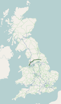
A59 road (Great Britain)
The A59 is a major road in England which runs from Wallasey, Merseyside to York, North Yorkshire.
The A59 begins in Wallasey at the northern end of the M53 motorway, heading through the Kingsway Tunnel. In the centre of Liverpool, a separate 0.7 miles (1.1 km) spur heads north from the roundabout junction at the entrance of the Queensway Tunnel, first as Byrom Street, joining the main route at Scotland Road in Vauxhall. It continues north as Kirkdale Road, Walton Road and County Road, then as Rice Lane and to Walton Vale. It passes Aintree Racecourse as Warbreck Moor and Ormskirk Road (forming the boundary between Aintree and Netherton), before reaching the Switch Island junction, which is a large semi roundabout semi traffic light controlled junction, where the A5036, the M57, the M58 and the A59 all meet.
From the Switch Island junction the A59 travels through Maghull and Lydiate, into Lancashire through Aughton and thence to Ormskirk. This part of the road follows the same route as the Merseyrail Northern Line.
...
Wikipedia


