A22 road (Great Britain)
| A22 | |
|---|---|
 |
|

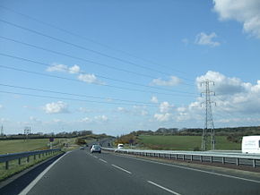
A22 in near Eastbourne in East Sussex.
|
|
| Major junctions | |
| North end: | London (Purley)51°20′15″N 0°07′00″W / 51.3375°N 0.1166°WCoordinates: 51°20′15″N 0°07′00″W / 51.3375°N 0.1166°W |
|
|
|
| South end: | Eastbourne50°47′06″N 0°16′26″E / 50.785°N 0.274°E |
| Location | |
|
Primary destinations: |
Croydon East Grinstead |
| Road network | |
The A22 is one of the two-digit major roads in the south east of England. Radial, it carries traffic from London to the Eastbourne area of the East Sussex coast, in which town it ends. For part of its route the A22 utilises the turnpikes opened in the 18th century:
By 1820 the road ran for 34 miles (54 km) from Stones End Street, Borough, London to Wych Cross. The road was extended north to Westminster Bridge which was later renamed the A23.
The A22 diverges from the A23 south of London at Purley Cross Junction (south of Purley). It runs over the North Downs into Surrey, crossing the M25 London Orbital Motorway just north of Godstone. This section incorporates the Caterham bypass, which opened in 1939 as one of the earliest such roads in the country, including the Wapses Lodge roundabout at the northern end. It then travels along the route of an ancient Roman road.
To the south of the M25, the road briefly enters West Sussex at Felbridge, just to the north of East Grinstead, and the A264 between Crawley and Tunbridge Wells merges with the A22 for a short section. The A22 bypasses East Grinstead town centre, running along a disused railway cutting, part of a line which closed as a consequence of the Beeching Report, which cut large numbers of local rail services. Richard Beeching was a local resident, and as a result, some local residents wanted to call this section the "Beeching Cut".
...
Wikipedia

