Año Nuevo State Park
| Año Nuevo State Park | |
|---|---|

Año Nuevo State Park
|
|
| Location | San Mateo County, California, USA |
| Nearest city | Pescadero, California |
| Coordinates | 37°7′59″N 122°19′59″W / 37.13306°N 122.33306°WCoordinates: 37°7′59″N 122°19′59″W / 37.13306°N 122.33306°W |
| Area | 4,209 acres (17.03 km2) |
| Established | 1985 |
| Governing body | California Department of Parks and Recreation |
| Designated | 1980 |
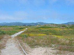
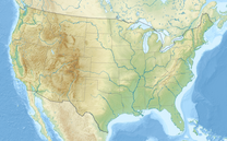
Año Nuevo State Park is a state park of California, USA, encompassing Año Nuevo Island and Año Nuevo Point, which are known for their pinniped rookeries. Located in San Mateo County, the low, rocky, windswept point juts out into the Pacific Ocean about 55 miles (89 km) south of San Francisco and the Golden Gate. Año Nuevo State Natural Reserve, formerly a separate unit of the California state park system, was merged into Año Nuevo State Park in October 2008.
The reserve contains a diversity of plant communities, including old growth forest freshwater marsh, red alder riparian forest and knobcone pine forest. Its four perennial streams support steelhead and coho salmon, and its wetlands are habitat to the rare San Francisco garter snake and California red-legged frog. Cultural resources include the remnants of a prehistoric Native American village site and a number of structures from the 19th century Cascade Ranch. In conjunction with adjacent and nearby public lands, the unit permits the protection of important regional ecological corridors.
The point remains undeveloped, much as Sebastián Vizcaíno saw it from his passing ship in 1603.
The Quiroste Ohlone people were the first known to inhabit the Año Nuevo area. After Mission Santa Cruz was founded in 1791, the Quiroste population plunged due to the various diseases that the Spanish had brought with them.
...
Wikipedia


