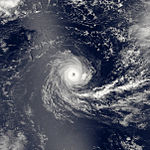
1981–82 South-West Indian Ocean cyclone season
| 1981–82 South-West Indian Ocean cyclone season |

Season summary map
|
| Seasonal boundaries |
| First system formed |
18 October 1981 |
| Last system dissipated |
4 May 1982 |
| Strongest storm |
|
| Name |
Chris-Damia |
| • Maximum winds |
215 km/h (130 mph)
(10-minute sustained) |
| • Lowest pressure |
898 hPa (mbar) |
| Seasonal statistics |
| Total depressions |
14 |
| Total storms |
10 |
| Tropical cyclones |
5 |
| Intense tropical cyclones |
2 |
| Total fatalities |
100 |
| Total damage |
$250 million (1982 USD) |
| Related articles |
|
|
South-West Indian Ocean tropical cyclone seasons
1979–80, 1980–81, 1981–82, 1982–83, 1983–84
|
| Tropical cyclone (MFR) |
| Category 2 tropical cyclone (SSHWS) |
|
|
| Duration |
October 18 – October 27 |
| Peak intensity |
150 km/h (90 mph) (10-min) 964 hPa (mbar) |
| Severe tropical storm (MFR) |
| Category 1 tropical cyclone (SSHWS) |
|
|
| Duration |
November 6 – November 20 |
| Peak intensity |
100 km/h (65 mph) (10-min) 976 hPa (mbar) |
| Tropical cyclone (MFR) |
| Category 2 tropical cyclone (SSHWS) |
|
|
| Duration |
December 17 – December 25 |
| Peak intensity |
135 km/h (85 mph) (10-min) 954 hPa (mbar) |
| Tropical depression (MFR) |
| Tropical storm (SSHWS) |
|
|
| Duration |
December 29 – January 7 |
| Peak intensity |
50 km/h (30 mph) (10-min) 990 hPa (mbar) |
| Intense tropical cyclone (MFR) |
| Category 4 tropical cyclone (SSHWS) |
|
|
| Duration |
January 6 – January 21 |
| Peak intensity |
215 km/h (130 mph) (10-min) 898 hPa (mbar) |
| Moderate tropical storm (MFR) |
| Tropical storm (SSHWS) |
|
|
| Duration |
January 30 – February 6 |
| Peak intensity |
80 km/h (50 mph) (10-min) 984 hPa (mbar) |
| Moderate tropical storm (MFR) |
| Tropical storm (SSHWS) |
|
|
| Duration |
January 31 – February 1 |
| Peak intensity |
65 km/h (40 mph) (10-min) 991 hPa (mbar) |
| Moderate tropical storm (MFR) |
| Category 1 tropical cyclone (SSHWS) |
|
|
| Duration |
February 5 – February 11 |
| Peak intensity |
80 km/h (50 mph) (10-min) 984 hPa (mbar) |
| Tropical cyclone (MFR) |
| Category 1 tropical cyclone (SSHWS) |
|
|
| Duration |
March 16 – March 25 |
| Peak intensity |
150 km/h (95 mph) (10-min) 941 hPa (mbar) |
The 1981–82 South-West Indian Ocean cyclone season was destructive and deadly in Madagascar, where four cyclones killed 100 people and caused $250 million (USD) in damage. The season was fairly active, lasting from October to May. There were nine named storms that attained gale-force winds, or at least 65 km/h (40 mph). Five of the storms attained tropical cyclone status, which have 10 minute sustained winds of at least 120 km/h (75 mph).
The first storm was Tropical Cyclone Alex, which was named by the Australian Bureau of Meteorology (BoM). this was due to the boundary of the basin at the time, which incorporated the Indian Ocean south of the equator and extended from the east coast of Africa to 80° E; the eastern extent was later moved to 90° E. Two other storms – Armelle and Damia – also originated in the Australian basin. The latter was the strongest cyclone on record in the basin at the time by barometric pressure, estimated at 898 millibars (898 hPa). The first storm to affect Madagascar was Benedicte in December, and was followed by tropical storms Frida and Electre in February and Justine in March. The final storm of the season was Cyclone Karla, which remained in the eastern periphery of the basin while reaching winds of 170 km/h (105 mph).
Météo-France's meteorological office at Réunion (MFR) issued advisories for storms in the basin during the year. At the time, the MFR area of warning responsibility was from the coast of Africa to 80° E, and the agency primarily used the Dvorak technique to estimate the intensities of tropical cyclones. The nine tropical storms and five tropical cyclones was identical to the long-term average from 1981 to 2011.
The Joint Typhoon Warning Center (JTWC), which is a joint United States Navy – United States Air Force task force that issues tropical cyclone warnings for the region, also issued advisories for storms in the year. The agency tracked a tropical depression in July 1982. The system formed on July 4 southeast of Seychelles, and initially curved to the southwest. It failed to intensify beyond winds of 55 km/h (35 mph), and dissipated on July 4 after turning to the northwest. At the time, the annual tropical cyclone year was from August 1 to July 31 of the subsequent year.
...
Wikipedia


