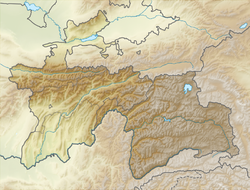
1911 Sarez earthquake
| Date | 18 February 1911 |
|---|---|
| Origin time | 18:41 UTC |
| Magnitude | 7.4 Ms |
| Depth | 26 km |
| Epicenter | 38°12′N 72°48′E / 38.2°N 72.8°ECoordinates: 38°12′N 72°48′E / 38.2°N 72.8°E |
| Areas affected | Tajikistan, Rushon District |
| Max. intensity | IX (Violent) |
| Casualties | 90 |
The 1911 Sarez earthquake occurred at 18:41 UTC on 18 February (23:31 local time) in the central Pamir Mountains in the Rushon District of eastern Tajikistan. It had an estimated magnitude of 7.4 on the surface wave magnitude scale and a maximum felt intensity of about IX (Violent) on the Mercalli intensity scale. It triggered a massive landslide, blocking the Murghab River and forming the Usoi Dam, the tallest dam in the world, creating Sarez Lake. The earthquake and related landslides destroyed many buildings and killed about 90 people.
The earthquake epicenter is located in the central Pamir Mountains. These mountains form the western end of the Himalayan chain, caused by the continuing continental collision between the northward moving Indian Plate and the Eurasian Plate. The area is affected by active faulting on both thrust faults and strike-slip faults. The 1911 earthquake occurred within the Pamir Hindu Kush seismic zone, which is regularly affected by earthquakes, some of which have magnitudes of 7 or greater.
The earthquake lasted for two minutes and was followed by an aftershock an hour later. The energy radiated by this event was one of the first to be estimated from seismograph recordings of seismic waves. Current estimates for the magnitude lie in the range 7.4–7.6 on the surface wave magnitude scale. The earthquake caused the waters of Lake Karakul to surge over its eastern rim, leaving behind a large sheet of ice as it withdrew.
...
Wikipedia

