1906 Valparaíso earthquake

Epicentral location
|
|
| Date | 19:55:39, August 16, 1906 (UTC-4) |
|---|---|
| Magnitude | 8.2 Mw |
| Depth | 25 km (16 mi) |
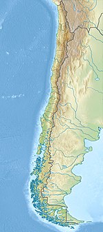
| Epicenter | Offshore Valparaíso Region, Chile 32°59′32.83″S 72°0′1.2″W / 32.9924528°S 72.000333°WCoordinates: 32°59′32.83″S 72°0′1.2″W / 32.9924528°S 72.000333°W |
| Areas affected | Chile |
| Tsunami | Yes |
| Casualties | 3,882 dead |
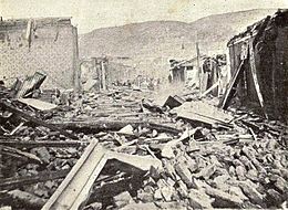
The 1906 Valparaíso earthquake hit Valparaíso, Chile, on August 16 at 19:55 local time. Its epicenter was offshore from the Valparaíso Region, and its intensity was estimated at magnitude 8.2 MW.
Much of Valparaíso was destroyed; there was severe damage in central Chile from Illapel to Talca. The earthquake was felt from Tacna, Peru to Puerto Montt. Reports said the earthquake lasted four minutes. A tsunami was also generated. The earthquake killed a reported 3,886 people.
The record of previous seismic activity includes major earthquakes in 1647, 1730 and 1822. The 1906 disaster was predicted by Captain Arturo Middleton, Chief of the Chilean Army Meteorological Office, in a letter that was published in El Mercurio, one week before it occurred.
Admiral Luis Gómez Carreño ordered the shooting of at least 15 people, who were caught looting after the earthquake. A Board for Reconstruction was formed some weeks after the earthquake. The Seismological Service of Chile was also created. Fernand de Montessus de Ballore was appointed as the first chief executive of the Service.
Chile lies above a convergent plate boundary, an area where the Nazca Plate under the Pacific Ocean is subducted or moved beneath the South American Plate. In the region around Valparaiso, the rate of convergence is about 70 mm/yr. As these two plates converge, it drives the Nazca plate with massive movements called megathrust earthquakes. The 1906 event was one of many large earthquakes in Chile along this plate boundary. Earthquakes can originate at the plate interface itself or within either the subducting or overriding plates.
...
Wikipedia

