11th Milestone
| 11th Milestone | |
|---|---|

The 'Garrow' metal 13th Milestone on the A3 Castletown to Ramsey Road at the 11th Milestone ('Drinkwater's Bend').
|
|
| Coordinates | 54°14′43″N 4°35′48″W / 54.24528°N 4.59667°WCoordinates: 54°14′43″N 4°35′48″W / 54.24528°N 4.59667°W |
| Built | 1850–1860 |
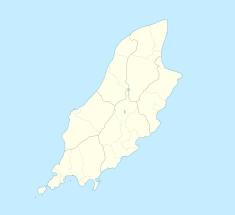
11th Milestone, Isle of Man (previously 'Drinkwater's Bend') is situated between the 11th and 12th Milestone racing road-side markers on the Snaefell Mountain Course used for the Isle of Man TT races on the primary A3 Castletown to Ramsey Road which forms the boundary between the parishes of German and Michael in the Isle of Man.
The distinctive elongated S-bend corner was part of the Highland Course and Four Inch Course used for the Gordon Bennett Trial and Tourist Trophy automobile car races held in the Isle of Man between 1904 and 1922. The 11th Milestone was part of the St John's Short Course used between 1907 and 1910 and part of the Snaefell Mountain Course used since 1911 for the Isle of Man TT Races and from 1923 the Manx Grand Prix Races.
During the 1949 350 cc Junior TT race the popular amateur racer Ben Drinkwater crashed fatally at this point and the corner became known as Drinkwater's Bend, although subsequently the name became disused.
The corner was subjected to road surface repair work and re-profiling during the winter of 2005/2006 by the Department of Transport.
The area is dominated by the Ballamenagh and Shoughlaige-e-Caine farmland. During 1850s, the primary A3 Road Castletown to Ramsey was re-profiled between Cronk-y-Voddy and Handley's Corner under the Isle of Man parish board system. This was to avoid marshland and steep inclines creating the distinctive elongated S-bend.
...
Wikipedia

