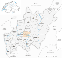
Échallens
| Échallens | ||
|---|---|---|
 |
||
|
||
| Coordinates: 46°38′N 6°38′E / 46.633°N 6.633°ECoordinates: 46°38′N 6°38′E / 46.633°N 6.633°E | ||
| Country | Switzerland | |
| Canton | Vaud | |
| District | Gros-de-Vaud | |
| Government | ||
| • Mayor | Syndic | |
| Area | ||
| • Total | 6.66 km2 (2.57 sq mi) | |
| Elevation | 617 m (2,024 ft) | |
| Population (Dec 2015) | ||
| • Total | 5,626 | |
| • Density | 840/km2 (2,200/sq mi) | |
| Postal code | 1040 | |
| SFOS number | 5518 | |
| Surrounded by | Villars-le-Terroir, Poliez-le-Grand, Bottens, Malapalud, Assens, Saint-Barthélemy, Goumoens-la-Ville. | |
| Website |
www Profile (French), SFSO statistics |
|
Échallens is a municipality in the district of Gros-de-Vaud in the canton of Vaud in Switzerland.
The territory of the municipality was already settled very early. There are remains of a Bronze Age foundry.
The first documentation dates from 1141 under the name of Charlens. Later forms of the name include Challeins, Escharlens (1177), Eschallens (1228), and Eschalleins (1279). The present form of the name first appears in 1315. The name comes from the personal name Charles.
The site belonged originally to the Bishop of Lausanne. At the end of the 12th century, the Burgundian Lords of Montfaucon established the territory of Échallens and built a castle there in the 13th century. In 1317, the rights of the house of Savoy were recognized. In 1350, Échallens was encircled by a wall and received city rights in 1351. From then until the 16th century, a weekly market was held.
In 1410, the government of Échallens passed to the house of Chalon, which originated in Burgundy. For this reason, the Eidgenossen took over after the Burgundian Wars and put it under the administration of Fribourg and Bern in 1476.
Because of the common administration of Catholic Fribourg and Protestant Bern, the Reformation did not gain ground in Echallen, and it remained Catholic.
Échallens belonged from 1798 to 1803 to the canton of Léman in the Helvetic Republic, and was brought into the canton of Vaud by the mediation of Napoleon. It has been the capital of the district since 1798.
Échallens has an area, as of 2009[update], of 6.66 square kilometers (2.57 sq mi). Of this area, 4.25 km2 (1.64 sq mi) or 63.8% is used for agricultural purposes, while 0.87 km2 (0.34 sq mi) or 13.1% is forested. Of the rest of the land, 1.48 km2 (0.57 sq mi) or 22.2% is settled (buildings or roads), 0.05 km2 (12 acres) or 0.8% is either rivers or lakes and 0.02 km2 (4.9 acres) or 0.3% is unproductive land.
...
Wikipedia


