Wearside
| Wearside | |
|---|---|
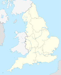
| Location of Wearside in England | |
| Coordinates: 54°54′14″N 1°22′52″W / 54.90389°N 1.38111°WCoordinates: 54°54′14″N 1°22′52″W / 54.90389°N 1.38111°W | |
| Sovereign state | United Kingdom |
| Country | England |
| Region | North East |
| Population (2011) | |
| • Total | 335,415 |
| Time zone | GMT (UTC) |
| • Summer (DST) | BST (UTC+1) |
Wearside /ˈwɪərsʌɪd/ is an area of North East England centred on the continuous urban area of Sunderland by the River Wear, and in the wider sense, including separate neighbouring settlements such as Seaham.
The Wearside conurbation, defined by the ONS as the Sunderland Built-up Area, has a population around 335,415 and includes two major settlements, Sunderland and Washington, as well as many smaller settlements which form part of the continuous urban area, including Whitburn, Hetton-le-Hole, Bournmoor, South Hetton, Springwell Village, Ouston, Pelton, Chester-Le-Street and Houghton-le-Spring. Most of this area forms the local government district named the City of Sunderland which has a lower population of 280,807.
Like other parts of the North East, Wearside and Sunderland were economically structured by Primary industry; with a great deal of the economy once dependent on ship building and coal mining with large collieries such as Monkwearmouth Colliery, which declined rapidly during the mid 20th century, many areas have long been deprived with vast areas of unemployment as a result. The city of Sunderland and parts of Wearside have been slowly rejuvenated over the years and industry is now largely based around call centres, although many areas such as Easington still face social problems today.
...
Wikipedia

