Ted Stevens Anchorage International Airport
| Ted Stevens Anchorage International Airport | |||||||||||||||||||
|---|---|---|---|---|---|---|---|---|---|---|---|---|---|---|---|---|---|---|---|
 |
|||||||||||||||||||
 |
|||||||||||||||||||
| Summary | |||||||||||||||||||
| Airport type | Public | ||||||||||||||||||
| Owner | State of Alaska DOT&PF | ||||||||||||||||||
| Serves | Anchorage, Alaska | ||||||||||||||||||
| Hub for |
Passenger Cargo |
||||||||||||||||||
| Elevation AMSL | 151 ft / 46 m | ||||||||||||||||||
| Coordinates | 61°10′27″N 149°59′54″W / 61.17417°N 149.99833°WCoordinates: 61°10′27″N 149°59′54″W / 61.17417°N 149.99833°W | ||||||||||||||||||
| Website | www |
||||||||||||||||||
| Map | |||||||||||||||||||
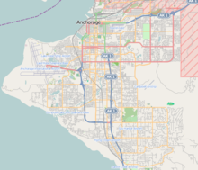
| Location of airport in Anchorage | |||||||||||||||||||
| Runways | |||||||||||||||||||
|
|||||||||||||||||||
| Helipads | |||||||||||||||||||
|
|||||||||||||||||||
| Statistics (2015) | |||||||||||||||||||
|
|||||||||||||||||||
|
Source: Federal Aviation Administration
|
|||||||||||||||||||
| Aircraft Operations | 261,961 |
|---|---|
| Based Aircraft | 109 |
| Passengers | 2,525,893 |
| Freight | 17,139,250,601 lbs |
Passenger
Cargo
Ted Stevens Anchorage International Airport (IATA: ANC, ICAO: PANC, FAA LID: ANC) is a major airport in the U.S. state of Alaska, located 5 miles (8 kilometers) southwest of downtown Anchorage. The airport is named in honor of Ted Stevens, the U.S. Senator from Alaska serving from 1968 to 2009. It is included in the National Plan of Integrated Airport Systems, which categorized it as a primary commercial service (medium hub) airport based on 2,249,717 enplanements in 2012.
Built in 1951 as Anchorage International Airport, the airport was served in the 1950s by Alaska Airlines, Northwest Orient, Pacific Northern Airlines and Reeve Aleutian Airways, using aircraft ranging from Douglas DC-3s to Boeing 377s, and was also a refueling stop for Canadian Pacific Air Lines service to the Far East (one such aircraft being involved in a 1951 disappearance). From 1955 to 2011, the eastern end of the airport's southernmost runway connected to the Kulis Air National Guard Base, which was located on land leased by the airport.
...
Wikipedia

