Dayton's Bluff, Saint Paul
| Dayton's Bluff | |
|---|---|
| Neighborhood | |
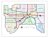
 Map of neighborhoods in the city of Saint Paul, Minnesota |
|
| Country | United States |
| State | Minnesota |
| County | Ramsey |
| City | Saint Paul |
| Area | |
| • Total | 2.837 sq mi (7.35 km2) |
| Population (2010) | |
| • Total | 17,916 |
| • Density | 6,300/sq mi (2,400/km2) |
| Time zone | CST (UTC-6) |
| • Summer (DST) | CDT (UTC-5) |
| ZIP code | 55101, 55106 |
| Area code(s) | 651 |
| Website | http://www.daytonsbluff.org/ |
Dayton's Bluff is a neighborhood located on the east side of the Mississippi River in the southeast part of the city of Saint Paul, Minnesota which has a large residential district on the plateau extending backward from its top. The name of the bluff commemorates Lyman Dayton, for whom a city in Hennepin County was also named. On the edge of the southern and highest part of Dayton's bluff, in Indian Mounds Park, is a series of seven large aboriginal mounds, 4 to 18 feet (1.2 to 5.5 m) high, that overlook the river and the central part of the city.
Dayton's Bluff contains remnants of the earliest inhabitants of the Twin Cities. The landmarks found in its historic district and the community around it tell the story. Indian Mounds Park preserves some of the burial sites of an early group that came to the area more than a thousand years ago.
Kaposia, a large Dakota Indian village, existed below Dayton's Bluff from the late seventeenth century until the mid-nineteenth century. Its residents lived along the river and performed their burial rites on the cliffs above. They were followed by the Metis (mixed bloods) and European-American farmers— often former Fort Snelling soldiers who tilled the land in the late 1830s and 1840s. The sacred site of Carver's Cave was destroyed by railroad construction in the 1880s.
The development of Dayton's Bluff as a “suburban” residential location began in the 1840s. The area was named for Lyman Dayton, an early pioneer real estate operator who owned extensive properties and built a home on the Bluff in the 1850s. The community became part of what historians call “the walking city” and was started so early that many of its streets were laid out parallel to the Mississippi River rather than in a north/south manner.
Feed, flour, and lumber mills were built in the area in the 1850s to take advantage of Phalen Creek as a source of water power. When a railroad was built north of East 7th Street in the late 1860s, more industries, including Hamm's Brewery, grew up along its corridor. Soon a railroad depot called “Post's Siding” was built at present-day Earl Street and East 7th Street, and a community of workers surrounded the industries. It was the start of what would be a long history of manufacturing in the community.
...
Wikipedia
