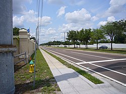
Town ’N Country, Florida
| Town 'n' Country | |
|---|---|
| Census-designated place | |

Town 'n' Country
|
|
 |
|
 Location in Hillsborough County and the state of Florida |
|
| Coordinates: 28°0′36″N 82°34′22″W / 28.01000°N 82.57278°WCoordinates: 28°0′36″N 82°34′22″W / 28.01000°N 82.57278°W | |
| Country | United States |
| State | Florida |
| County | Hillsborough |
| Area | |
| • Total | 24.1 sq mi (62.5 km2) |
| • Land | 22.1 sq mi (57.3 km2) |
| • Water | 2.0 sq mi (5.2 km2) |
| Elevation | 6 ft (2 m) |
| Population (2010) | |
| • Total | 78,442 |
| • Density | 3,548/sq mi (1,369.7/km2) |
| Time zone | Eastern (EST) (UTC-5) |
| • Summer (DST) | EDT (UTC-4) |
| ZIP code | 33615 |
| Area code(s) | 813 |
| FIPS code | 12-72145 |
| GNIS feature ID | 1867220 |
Town 'n' Country is a census-designated place (CDP) in Hillsborough County, Florida, United States. The population was 78,442 at the 2010 census.
Within Town 'n' Country are located Bay Crest Park, Countryway, Rocky Creek, Sweetwater Creek.
Settled in 1956 as a dairy farm, it remained rural until suburbanization occurred during the 1960s and the 1970s.
The ZIP code for Town 'n' Country is 33615; other nearby ZIP codes include 33634 and 33635.
Town 'n' Country is located in western Hillsborough County at 28°0′36″N 82°34′22″W / 28.01000°N 82.57278°W (28.010046, -82.572815). It is bordered to the south by the city of Tampa and is about 12 miles (19 km) northwest of downtown. The CDP is bordered to the north by Westchase, Citrus Park, and Carrollwood, and to the east by Egypt Lake-Leto. To the west is the city of Oldsmar in Pinellas County. The northwest portion of Tampa International Airport is located within Town 'n' Country CDP.
...
Wikipedia
