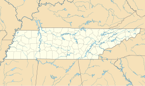
Stones River National Battlefield
| Stones River National Battlefield | |
|---|---|
|
IUCN category V (protected landscape/seascape)
|
|
| Location | Rutherford County, Tennessee, USA |
| Coordinates | 35°52′34″N 86°25′51″W / 35.87611°N 86.43083°WCoordinates: 35°52′34″N 86°25′51″W / 35.87611°N 86.43083°W |
| Area | 728.41 acres (294.78 ha) |
| Established | March 3, 1927 |
| Visitors | 206,425 (in 2005) |
| Governing body | National Park Service |
| Website | Stones River National Battlefield |
Stones River National Battlefield, a 570-acre (2.3 km2) park along the Stones River in Rutherford County, Tennessee, three miles (5 km) northwest of Murfreesboro and twenty-eight miles southeast of Nashville, memorializes the Battle of Stones River, a key battle of the American Civil War that took place on December 31, 1862 and January 2, 1863, which resulted in a strategic Union victory.
The national battlefield was established through the efforts of both private individuals, the Stones River Battlefield and Park Association, the Nashville, Chattanooga and St. Louis Railway (in 2011, part of CSX Transportation), and by a 1927 act of Congress authorizing a national military park under the jurisdiction of the War Department.
During the early years of the twentieth century, the railroad used the battlefield to increase passenger traffic. It promoted veteran reunions and acquired parts of the battlefield as points of historical interest. In 1906, the company erected a 31-foot (9.4 m) obelisk to commemorate the January 2, 1863, position of massed Union artillery used to repel a Confederate assault on Union troops across the river.
The Stones River Battlefield and Park Association was chartered on April 28, 1896, after the establishment of Chickamauga and Chattanooga National Military Park increased interest in preserving significant Civil War battlefields. The association secured options on property connected with the battle, reportedly 3,400 acres (14 km2) by June 1897. Association members erected wooden signs to mark and interpret battlefield locations. In 1912, the Association lobbied to have Congress “establish an accurate system of markers," but the measure failed, in part because of the testimony of former congressman and Chickamauga and Chattanooga National Park Commissioner Charles H. Grosvenor, who believed the landmarks had been "entirely obliterated."
...
Wikipedia


