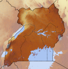
Rwenzori Mountains
| Rwenzori Mountains | |
|---|---|
 |
|
| Highest point | |
| Peak | Mount Stanley |
| Elevation | 5,109 m (16,762 ft) |
| Coordinates | 00°23′09″N 29°52′18″E / 0.38583°N 29.87167°ECoordinates: 00°23′09″N 29°52′18″E / 0.38583°N 29.87167°E |
| Dimensions | |
| Length | 120 km (75 mi) |
| Geography | |
| Country | Uganda, Democratic Republic of the Congo |
The Rwenzori Mountains, previously called the Ruwenzori Range (spelling changed around 1980 to conform more closely with the local name "Rwenjura"), and sometimes the Mountains of the Moon, is a mountain range of eastern equatorial Africa, located on the border between Uganda and the Democratic Republic of the Congo. The Rwenzori mountains support glaciers and are one source of the river Nile.
The Rwenzori Mountains reach heights up to 5,109 metres (16,762 ft). The highest Rwenzori peaks are permanently snow-capped. Rwenzori Mountains National Park and Virunga National Park are located in the range.
The mountains formed about three million years ago in the late Pliocene epoch and are the result of an uplifted block of crystalline rocks including gneiss, amphibolite, granite, and quartzite. They are on the flanks of the Albertine Rift, the western branch of the East African Rift.
This uplift divided the paleolake Obweruka and created three of the present-day African Great Lakes: Lake Albert, Lake Edward, and Lake George.
The range is about 120 kilometres (75 mi) long and 65 kilometres (40 mi) wide. It consists of six massifs separated by deep gorges: Mount Stanley (5,109 metres (16,762 ft)), Mount Speke (4,890 metres (16,040 ft)), Mount Baker (4,843 metres (15,889 ft)), Mount Emin (4,798 metres (15,741 ft)), Mount Gessi (4,715 metres (15,469 ft)), and Mount Luigi di Savoia (4,627 metres (15,180 ft)). Mount Stanley has several subsidiary summits, with Margherita Peak being the highest point. The rock is metamorphic, and the mountains are believed to have been tilted and squeezed upwards by plate movement. They are in an extremely humid area and frequently enveloped in clouds.
...
Wikipedia

