Norwegian Sea
| Norwegian Sea | |
|---|---|

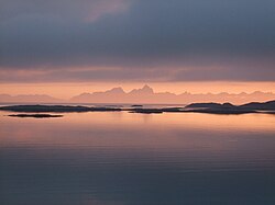
The Vestfjorden with the mountains of the Lofoten archipelago seen from Løvøy Island in Steigen. Vågakaillen (942 m) is the taller of the two peaks in the centre of the image.
|
|
 |
|
| Coordinates | 69°N 0°E / 69°N 0°ECoordinates: 69°N 0°E / 69°N 0°E |
| Type | Sea |
| Basin countries | Norway, Iceland |
| Surface area | 1,383,000 km2 (534,000 sq mi) |
| Average depth | 2,000 m (6,600 ft) |
| Max. depth | 3,970 m (13,020 ft) |
| Water volume | 2,000,000 km3 (1.6×10¹² acre·ft) |
| References | |
The Norwegian Sea (Norwegian: Norskehavet) is a marginal sea in the North Atlantic Ocean, northwest of Norway. It is located between the North Sea (i.e. north of the United Kingdom) and the Greenland Sea and adjoins the North Atlantic Ocean to the west and the Barents Sea to the northeast. In the southwest, it is separated from the Atlantic Ocean by a submarine ridge running between Iceland and the Faroe Islands. To the North, the Jan Mayen Ridge separates it from the Greenland Sea.
Unlike many other seas, most of the bottom of the Norwegian Sea is not part of a continental shelf and therefore lies at a great depth of about two kilometres on average. Rich deposits of oil and natural gas are found under the sea bottom and are being explored commercially, in the areas with sea depths of up to about one kilometre. The coastal zones are rich in fish that visit the Norwegian Sea from the North Atlantic or from the Barents Sea (cod) for spawning. The warm North Atlantic Current ensures relatively stable and high water temperatures, so that unlike the Arctic seas, the Norwegian Sea is ice-free throughout the year. Recent research has concluded that the large volume of water in the Norwegian Sea with its large heat absorption capacity is more important as a source of Norway's mild winters than the Gulf Stream and its extensions.
The International Hydrographic Organization defines the limits of the Norwegian Sea as follows:
The Norwegian Sea was formed about 250 million years ago, when the Eurasian plate of Norway and the North American Plate, including Greenland, started to move apart. The existing narrow shelf sea between Norway and Greenland began to widen and deepen. The present continental slope in the Norwegian Sea marks the border between Norway and Greenland as it stood approximately 250 million years ago. In the north it extends east from Svalbard and on the southwest between Britain and the Faroes. This continental slope contains rich fishing grounds and numerous coral reefs. Settling of the shelf after the separation of the continents has resulted in landslides, such as the Storegga Slide about 8,000 years ago that induced a major tsunami.
...
Wikipedia
