Ixelles
|
Ixelles Ixelles (French) Elsene (Dutch) |
|||
|---|---|---|---|
| Municipality | |||

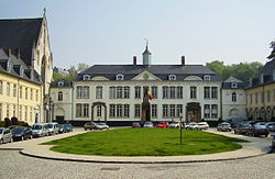
La Cambre Abbey in Ixelles.
|
|||
|
|||
| Location in Belgium | |||
| Coordinates: 50°50′N 04°22′E / 50.833°N 4.367°ECoordinates: 50°50′N 04°22′E / 50.833°N 4.367°E | |||
| Country | Belgium | ||
| Community |
Flemish Community French Community |
||
| Region | Brussels | ||
| Arrondissement | Brussels | ||
| Government | |||
| • Mayor | Dominique Dufourny (MR) | ||
| • Governing party/ies | MR, PS, sp.a | ||
| Area | |||
| • Total | 6.34 km2 (2.45 sq mi) | ||
| Population (1 January 2016) | |||
| • Total | 85,541 | ||
| • Density | 13,000/km2 (35,000/sq mi) | ||
| Postal codes | 1050 | ||
| Area codes | 02 | ||
| Website | www.ixelles.be | ||
Ixelles (French pronunciation: [iksɛl]; Dutch: Elsene pronounced [ˈɛlsənə]) is one of the nineteen municipalities located in the Brussels-Capital Region of Belgium. In common with all the Brussels municipalities, it is legally bilingual.
Ixelles is located in the suburbs towards the south of Brussels' city center and is geographically bisected by the City of Brussels municipality. It is generally considered an affluent area of the city and is particularly noted for its communities of European and Congolese immigrants.
Elsene/Ixelles is located in the south of Brussels and is divided into two parts by Louisalaan / Avenue Louise, which is part of the City of Brussels municipality. The smaller west part of the municipality includes Baljuwstraat/Rue du Bailli and extends roughly from Louisalaan/Avenue Louise to Brugmannlaan/Avenue Brugmann.
The larger east part of the municipality includes the campuses of Brussels' two leading universities, the Francophone Université Libre de Bruxelles and the Dutch-speaking Vrije Universiteit Brussel, along with the Place Eugène Flagey/Flageyplein. The Ter Kamerenbos/Bois de la Cambre is located just south of Elsene/Ixelles.
The construction of Louisalaan/Avenue Louise was commissioned in 1847 as a monumental avenue bordered by chestnut trees that would allow easy access to the popular recreational area of the Ter Kamerenbos/Bois de la Cambre. It was also to be the first Haussmann-esque artery of the city of Brussels. However, fierce resistance to the project was put up by the town of Elsene/Ixelles (which was then still separate from Brussels) through whose land the avenue was supposed to run. After years of fruitless negotiations, Brussels finally annexed the narrow band of land needed for the avenue plus the Ter Kamerenbos/Bois de la Cambre itself in 1864. That decision accounts for the unusual shape of today's City of Brussels and for Elsene/Ixelles being split in two separate parts.
...
Wikipedia


