Fort Simpson
|
Fort Simpson Liidlii Kue |
||
|---|---|---|
| Village | ||
 |
||
|
||
| Coordinates: 61°51′47″N 121°21′18″W / 61.86306°N 121.35500°WCoordinates: 61°51′47″N 121°21′18″W / 61.86306°N 121.35500°W | ||
| Country | Canada | |
| Territory | Northwest Territories | |
| Region | Dehcho Region | |
| Constituency | Nahendeh | |
| Census division | Region 4 | |
| Settled | 1803 | |
| Village | 1822 | |
| Village (incorporated) | 1 January 1973 | |
| Government | ||
| • Mayor | Darlene Sibbeston | |
| • Senior Administrative Officer | Bill Bennett | |
| • MLA | Shane Thompson | |
| Area | ||
| • Land | 78.32 km2 (30.24 sq mi) | |
| Elevation | 169 m (554 ft) | |
| Population (2011) | ||
| • Total | 1,238 | |
| • Density | 15.8/km2 (41/sq mi) | |
| Time zone | Mountain (MST) (UTC-7) | |
| • Summer (DST) | MDT (UTC-6) | |
| Canadian Postal code | X0E 0N0 | |
| Area code(s) | 867 | |
| Telephone exchange | 695 | |
| - Living cost | 137.5 | |
| - Food price index | 125.1 | |
| Website | www.fortsimpson.com | |
| Sources: Department of Municipal and Community Affairs, Prince of Wales Northern Heritage Centre, Canada Flight Supplement ^A 2009 figure based on Edmonton = 100 ^B 2010 figure based on Yellowknife = 100 |
||
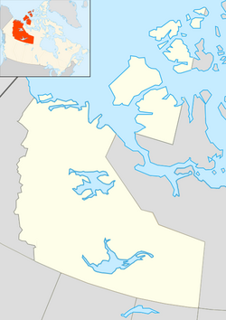
Fort Simpson (Slavey language: Liidli Kue "place where rivers come together") is a village, the only one in the entire territory, in the Dehcho Region of the Northwest Territories, Canada. The community is located on an island at the confluence of the Mackenzie and Liard Rivers. It is approximately 500 km (310 mi) west of Yellowknife. Both rivers were traditionally trade routes for the Hudson's Bay Company and the native Dene people of the area.
Fort Simpson is the regional centre of the Dehcho and is the gateway to the scenic South Nahanni River and the Nahanni National Park Reserve. Fort Simpson can be reached by air, water and road and has full secondary and elementary school service. The Mackenzie Highway was extended to Fort Simpson in 1970-71.
The central section of the community is on an island near the south bank of the Mackenzie River, but industrial areas and rural residential areas are located along the highway as far as the Fort Simpson Airport, just beyond which is the Liard River ferry crossing.
Population is 1,238 according to the 2011 Census, an increase of 1.8% over 2006. According to the 2006 Census there were 1,216 people and 820 were Aboriginal. Of these the majority, 715, of the residents are First Nations and the main languages are South Slavey and English. In 2012 the Government of the Northwest Territories reported that the population was 1,251 with an average yearly growth rate of 0.1% from 2001.
...
Wikipedia


