Enschede
| Enschede | |||||||||
|---|---|---|---|---|---|---|---|---|---|
| City and Municipality | |||||||||
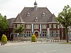
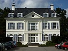
Images, from top down, left to right: Skyline of Enschede,
the Rijksmuseum Twenthe, the mansion, , Grolsch Veste stadium of FC Twente, , historic city centre of Enschede |
|||||||||
|
|||||||||
 Location in Overijssel |
|||||||||
| Coordinates: 52°13′N 6°54′E / 52.217°N 6.900°ECoordinates: 52°13′N 6°54′E / 52.217°N 6.900°E | |||||||||
| Country | Netherlands | ||||||||
| Province | Overijssel | ||||||||
| Government | |||||||||
| • Body | Municipal council | ||||||||
| • Mayor | Onno van Veldhuizen (D66) | ||||||||
| Area | |||||||||
| • Municipality | 142.72 km2 (55.10 sq mi) | ||||||||
| • Land | 141.00 km2 (54.44 sq mi) | ||||||||
| • Water | 1.72 km2 (0.66 sq mi) | ||||||||
| Elevation | 42 m (138 ft) | ||||||||
| Population (Municipality, May 2014; Urban and Metro, May 2014) | |||||||||
| • Municipality | 158,004 | ||||||||
| • Density | 1,121/km2 (2,900/sq mi) | ||||||||
| • Urban | 158,004 | ||||||||
| • Metro | 315,807 | ||||||||
| • Twente | 626,586 | ||||||||
| Demonym(s) | Enschedeër | ||||||||
| Time zone | CET (UTC+1) | ||||||||
| • Summer (DST) | CEST (UTC+2) | ||||||||
| Postcode | 7500–7549 | ||||||||
| Area code | 053 | ||||||||
| Website | www |
||||||||
Enschede (Dutch pronunciation: [ˈɛnsxəˌdeː]), also known as Eanske [ˈɛːnskə] in the local dialect of Twents, is a municipality and a city in the eastern Netherlands in the province of Overijssel and in the Twente region. The municipality of Enschede consisted of the city of Enschede until 1935, when the rural municipality of Lonneker, which surrounded the city, was annexed after the rapid industrial expansion of Enschede which began in the 1860s and involved the building of railways and the digging of the Twentekanaal.
Enschede lies in the eastern part of Overijssel and is the easternmost city of more than 100,000 inhabitants in the Netherlands. The city lies a few kilometres from Germany, which borders the municipality. In the west, Hengelo is the first important place and at the eastern side, Gronau plays that role. More than a few small rivers flow through or surround the city, such as the Roombeek and Glanerbeek.
Enschede contains five official city districts ("Stadsdelen"). Note that they also include surrounding villages in the municipality:
Like most of the Netherlands, Enschede features an oceanic climate (Cfb in the Köppen classification), however, winters tend to be less mild than the rest of the Netherlands due to its inland location. Although the former military airport is derelict and plans to revive the place are canceled in 2012, the Royal Netherlands Meteorological Institute still has its weather station there online.
The early history of Enschede is largely unknown, but a settlement existed around the Old Marketplace in early medieval times. The name of this settlement is mentioned as Anescede or Enscede meaning either "near the border" (with Bentheim) or "near the Es" and sported a church, a marketplace and a fortified aristocratic house.
...
Wikipedia


