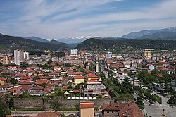
Elbasan
| Elbasan | ||
|---|---|---|
| Municipality | ||
 |
||
|
||
| Coordinates: 41°06′N 20°04′E / 41.100°N 20.067°ECoordinates: 41°06′N 20°04′E / 41.100°N 20.067°E | ||
| Country |
|
|
| County | Elbasan | |
| Government | ||
| • Mayor | Qazim Sejdini (SP) | |
| Area | ||
| • Municipality | 872.03 km2 (336.69 sq mi) | |
| • Administrative Unit | 12.90 km2 (4.98 sq mi) | |
| Elevation | 150 m (490 ft) | |
| Population (2015) | ||
| • Municipality | 141,714 | |
| • Municipality density | 160/km2 (420/sq mi) | |
| • Administrative Unit | 120,703 | |
| • Administrative Unit density | 9,400/km2 (24,000/sq mi) | |
| Time zone | CET (UTC+1) | |
| • Summer (DST) | CEST (UTC+2) | |
| Postal Code | 3001-3006 | |
| Area Code | (0)54 | |
| Vehicle registration | AL | |
| Website | Official Website | |
Elbasan (Albanian: Elbasan or Elbasani) is a city and a municipality in Elbasan County, central Albania. One of the largest cities in Albania, it is located on the Shkumbin River in the District of Elbasan and the County of Elbasan. The present municipality was formed at the 2015 local government reform by the merger of the former municipalities Bradashesh, Elbasan, Funarë, Gjergjan, Gjinar, Gracen, Labinot-Fushë, Labinot-Mal, Papër, Shirgjan, Shushicë, Tregan and Zavalinë, that became municipal units. The seat of the municipality is the city Elbasan. The total population is 141,714 (2011 census), in a total area of 872.03 km2. The population of the former municipality at the 2011 census was 78,703.
It was called Neokastron (New Castle) in Greek, Novigrad (new city) in Slavic and Terra Nuova in Italian. The modern name derives from the Turkish il-basan ("the fortress").
In August 2010 archaeologists discovered two Illyrian graves near the walls of the castle of Elbasan. In the second century BC, a trading post called Mansio Scampa near the site of modern Elbasan developed close to a junction of two branches of an important Roman road, the Via Egnatia, which connected the Adriatic coast with Byzantium. By the third or fourth century AD, this place had grown into a real city protected by a substantial Roman fortress with towers; the fort covered around 300 square meters. This city appears on late antique itineraries like the Tabula Peutingeriana or the Itinerarium Burdigalense as Scampis or Hiscampis.
...
Wikipedia


