Cheyenne, Wyoming
| Cheyenne, Wyoming | ||
|---|---|---|
| State Capital | ||
| City of Cheyenne | ||

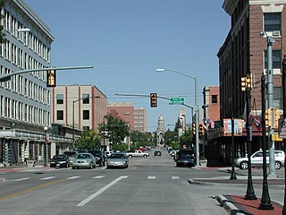
Capitol Ave. in Downtown Cheyenne
|
||
|
||
| Nickname(s): Magic City of the Plains; Capital City (of Wyoming); The Frontier City | ||
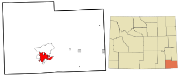
 Location in Laramie County and the state of Wyoming |
||
| Location in the United States | ||
| Coordinates: 41°8′44″N 104°48′7″W / 41.14556°N 104.80194°WCoordinates: 41°8′44″N 104°48′7″W / 41.14556°N 104.80194°W | ||
| Country | United States | |
| State | Wyoming | |
| County | Laramie | |
| Founded | 1867 | |
| Named for | Cheyenne people | |
| Government | ||
| • Mayor | Marian Orr | |
| Area | ||
| • City | 24.63 sq mi (63.79 km2) | |
| • Land | 24.52 sq mi (63.51 km2) | |
| • Water | 0.11 sq mi (0.28 km2) 0.45% | |
| Elevation | 6,062 ft (1,848 m) | |
| Population (2010) | ||
| • City | 59,466 | |
| • Estimate (2014) | 62,845 | |
| • Rank | US: 564th | |
| • Density | 2,425.2/sq mi (936.4/km2) | |
| • Urban | 73,588 (US: 377th) | |
| • Metro | 96,389 (US: 359th) | |
| Time zone | Mountain (UTC−7) | |
| • Summer (DST) | Mountain (UTC−6) | |
| Zip Code | 82001, 82002, 82003, 82006, 82007, 82008, 82009, 82010 | |
| Area code(s) | 307 | |
| FIPS code | 56-13900 | |
| GNIS feature ID | 1609077 | |
| Website | www |
|
|
|
||
Cheyenne (/ʃaɪˈæn/ shy-AN or /ʃaɪˈɛn/) is the capital and most populous city of the US state of Wyoming and the county seat of Laramie County. It is the principal city of the Cheyenne, Wyoming, Metropolitan Statistical Area which encompasses all of Laramie County. The population was 59,466 at the 2010 census. Cheyenne is the northern terminus of the extensive and fast-growing Front Range Urban Corridor that stretches from Cheyenne to Pueblo, Colorado, and has a population of 4,333,742 according to the 2010 United States Census. Cheyenne is situated on Crow Creek and Dry Creek. The Cheyenne, Wyoming Metropolitan Area had a 2010 population of 91,738, making it the 354th most populous metropolitan area in the United States.
On July 5, 1867, General Grenville M. Dodge and his survey crew plotted the site now known as Cheyenne in Dakota Territory (later Wyoming Territory). This site was chosen as the point at which the Union Pacific Railroad crossed Crow Creek, a tributary of the South Platte River. The city was not named by Dodge, as his memoirs state, but rather by friends who accompanied him to the area Dodge called "Crow Creek Crossing". It was named for the American Indian Cheyenne nation, one of the most famous and prominent Great Plains tribes closely allied with the Arapaho.
...
Wikipedia


