Bakersfield, California
| Bakersfield, California | ||||||
|---|---|---|---|---|---|---|
| Charter city and county seat | ||||||
| City of Bakersfield | ||||||
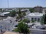
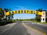
Images, clockwise from top: A panoramic view of Bakersfield; the Bakersfield Sign; the Rabobank Arena; Downtown Bakersfield.
|
||||||
|
||||||
| Nickname(s): "Nashville West" | ||||||
 Location of Bakersfield, California |
||||||
| Location in the contiguous United States | ||||||
| Coordinates: 35°22′N 119°1′W / 35.367°N 119.017°WCoordinates: 35°22′N 119°1′W / 35.367°N 119.017°W | ||||||
| Country | United States of America | |||||
| State | California | |||||
| County | Kern | |||||
| Region | San Joaquin Valley | |||||
| Incorporated | 1873–1876 | |||||
| Re-incorporated | January 11, 1898 | |||||
| Named for | Thomas Baker | |||||
| Government | ||||||
| • Type | Council-Manager | |||||
| • Body | Bakersfield City Council | |||||
| • Mayor | Karen Goh | |||||
| • City Manager | Alan Tandy | |||||
| • Finance director | Nelson Smith | |||||
| • City clerk | Roberta Gafford | |||||
| Area | ||||||
| • City | 143.609 sq mi (371.946 km2) | |||||
| • Land | 142.164 sq mi (368.204 km2) | |||||
| • Water | 1.445 sq mi (3.742 km2) 1.01% | |||||
| • Urban | 138.44 sq mi (358.6 km2) | |||||
| • Metro | 8,161.42 sq mi (21,138.0 km2) | |||||
| Elevation | 404 ft (123 m) | |||||
| Population (April 1, 2010) | ||||||
| • City | 347,483 | |||||
| • Estimate (2015) | 373,640 | |||||
| • Rank |
1st in Kern County 9th in California 52nd in the United States |
|||||
| • Density | 2,400/sq mi (930/km2) | |||||
| • Urban | 523,994 | |||||
| • Urban density | 3,800/sq mi (1,500/km2) | |||||
| • Metro | 839,631 | |||||
| • Metro density | 100/sq mi (40/km2) | |||||
| Demonym(s) | Bakersfieldian | |||||
| Time zone | Pacific (UTC−8) | |||||
| • Summer (DST) | PDT (UTC−7) | |||||
| ZIP codes | 93220, 93241, 93301–93309, 93311–93314, 93263, 93380–93390, 93399 | |||||
| Area code | 661 | |||||
| FIPS code | 06-03526 | |||||
| GNIS feature IDs | 1652668, 2409774 | |||||
| Website | www |
|||||
Bakersfield is a city located in the San Joaquin Valley of California, where it sits on the southern end of the Central Valley within the Kern County boundaries. The city is 110 mi (180 km) north of Los Angeles and about the same distance south of Fresno. Bakersfield's population is approximately 365,000, making it the 9th largest city in California and the 52nd largest city in the United States. The city is also the county seat for Kern County, which encompasses the entire MSA. The total Bakersfield inner urban area, which includes East Bakersfield and Rosedale, has a population of about 464,000.
Bakersfield is located in the San Joaquin Valley which lies mainly in Central California, although a small part of the valley overlaps into the northern portion of Southern California. Geographically, Bakersfield itself is part of Southern California, but is heavily aligned with the Central Valley region due to Bakersfield being a hub for agriculture and oil production.
Bakersfield is the focal point of the larger Bakersfield-Delano, CA Metropolitan Statistical Area, which is coextensive with Kern County. In 2010, it had a population of 839,631, making it the 62nd largest metropolitan area in United States.
Bakersfield has a very diverse economy. Kern County is the most productive oil producing county, and the fourth most productive agricultural county (by value) in the United States. Industries include natural gas and other energy extraction, aerospace, mining, petroleum refining, manufacturing, distribution, food processing, and corporate/regional headquarters.
...
Wikipedia


